

Faenza, May 13–14, 2026
The 5th Transnational Project Meeting of the AIMS project — Development and Testing of a Shared, AI-Based Predictive Model for a Coordinated Use of Big Data and for a Joint Monitoring System of Landslides Risk in the Adriatic-Ionian Region — took place on May 13–14, 2026, in Faenza, Italy, bringing together partners from across the ADRION region for two intensive days of technical work, knowledge exchange, and collaborative planning.
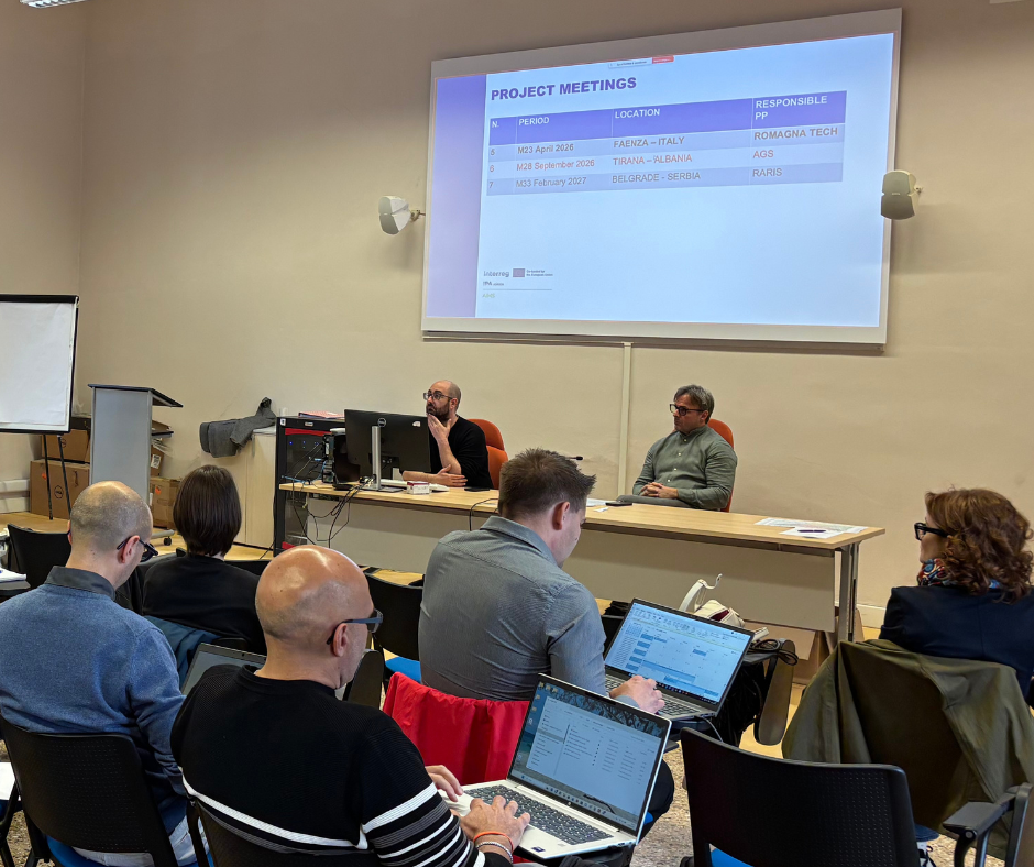
The meeting was opportunity to review management status, mid-term review outcomes, and financial performance of the Project. Partners have made a comprehensive overview of the current state of implementation and made plans for the next six-month period.
A significant portion of the agenda was devoted to the activities that are core of the project, focused on the testing of the Landslides Monitoring and Early Prediction System for the ADRION region. Key highlights included:
- Romagna Tech presented the updated AIMS Data Management Platform, showcasing progress in the design and development of an interoperable data collection infrastructure capable of supporting transnational landslide monitoring at scale.
- All partners engaged in a joint discussion on pilot implementation, which will lead to the installment of data collection infrastructures on landslides in Italy, Slovenia, Albania, BIH and Greece. The pilots will use the experiences from the conclusions based on transnational roundtables held with domain experts to define and refine the monitoring and early prediction framework across participating countries.
The afternoon sessions of the first day enriched the meeting with scientific depth and hands-on learning. Matteo Berti and Alessandro Zuccarini from the University of Bologna delivered an in-depth presentation on the challenges and opportunities of continuous monitoring, using the Settefonti pilot site as a case study — a valuable real-world example of the complexities involved in long-term landslide surveillance. During the second day of the partner meeting, participants went on the field and had opportunity to see Settefonti pilot side in real life.
The day concluded with a training workshop on ML-based LiDAR landslide mapping within AIMS, organized by the Croatian Geological Survey) in collaboration with the University of Zagreb. The workshop covered the importance of landslide inventories and the LADY approach, a technical overview of machine learning applications for landslide detection from LiDAR data and practical mapping instructions for delineating landslides on LiDAR derivatives.
The AIMS project continues to make meaningful strides toward delivering an integrated, AI-powered system for landslide risk monitoring across the Adriatic-Ionian region — a tool with significant potential for disaster risk reduction and civil protection across the participating countries.